
Anúncios
Measuring land accurately is essential for property owners, builders, farmers, and anyone involved in real estate or land development projects.


Whether you’re planning to purchase a plot, divide an inherited property, install a fence, or design a landscaping project, knowing the exact dimensions of your terrain prevents costly mistakes and legal disputes. The good news is that modern technology has transformed this once complex task into something anyone can accomplish with the right tools and knowledge.
From traditional surveying methods that professionals have used for centuries to cutting-edge GPS applications that fit in your pocket, the options for measuring land have never been more accessible. Understanding which method suits your specific needs can save you time, money, and frustration while ensuring precision in your measurements.
📐 Why Accurate Land Measurement Matters
Precision in land measurement isn’t just about numbers on paper. It directly impacts property values, taxation, construction planning, and legal boundaries. An error of just a few feet can mean the difference between a compliant building permit and a rejected application.
Farmers rely on accurate field measurements to calculate seed quantities, fertilizer needs, and irrigation coverage. Real estate transactions depend on verified lot sizes to determine fair market values. Even homeowners planning a simple garden project benefit from knowing exact dimensions to order the right amount of materials.
Legal disputes over property boundaries have cost landowners thousands of dollars in court fees and settlements. Professional surveys establish undisputed boundaries that protect your investment and maintain good relationships with neighbors. Prevention through accurate initial measurement always costs less than correction after problems arise.
🗺️ Traditional Methods Still in Use Today
Before digital technology revolutionized the field, surveyors developed remarkably accurate techniques using simple tools. Many of these methods remain valuable for quick estimates or situations where technology isn’t available or practical.
The Measuring Tape Approach
For small, rectangular plots, a quality measuring tape provides sufficient accuracy. This method works best on relatively flat terrain with clear boundaries. Two people working together can measure lengths and widths, then calculate area using basic multiplication.
The key to success with tape measurements lies in keeping the tape taut and level. Slopes and uneven ground introduce errors that compound over distance. For plots larger than a typical residential lot, this method becomes increasingly impractical and prone to inaccuracy.
Surveyor’s Wheel Method
Also called a measuring wheel or clickwheel, this tool consists of a wheel attached to a handle that clicks at set distance intervals. Users simply walk the perimeter while the device tracks distance mechanically.
While more convenient than tape measures for larger areas, surveyor’s wheels still require relatively clear paths and don’t account for irregular shapes well. They provide decent estimates but shouldn’t be relied upon for legal or construction purposes requiring high precision.
📱 Modern Digital Solutions Transform Land Measurement
Smartphone applications have democratized land measurement, putting professional-grade capabilities into the hands of everyday property owners. These apps leverage GPS technology and satellite imagery to calculate land areas with impressive accuracy.
The best measurement apps allow users to simply walk the perimeter of their property while their phone tracks their movement. The software automatically calculates area, perimeter, and can even measure distances between specific points. Many offer multiple unit options including acres, hectares, square feet, and square meters.

Advanced features in premium measurement applications include the ability to save multiple properties, export data, overlay measurements on satellite maps, and share results with contractors or real estate professionals. Some integrate with cloud services for backup and cross-device access.
🛰️ GPS Technology and Its Accuracy Levels
Consumer GPS devices, including smartphones, typically achieve accuracy within 15-30 feet under optimal conditions. While this might seem imprecise, for many agricultural and property management purposes, this level of accuracy proves entirely adequate.
GPS accuracy depends on several factors including satellite visibility, atmospheric conditions, and device quality. Open fields with clear sky views yield better results than forested areas or locations surrounded by tall buildings. Some professional-grade GPS units achieve sub-meter accuracy through differential correction techniques.
For legal boundary establishment, professional surveying equipment using RTK (Real-Time Kinematic) GPS provides centimeter-level accuracy. These systems cost thousands of dollars but deliver the precision required for official property records and legal documentation.
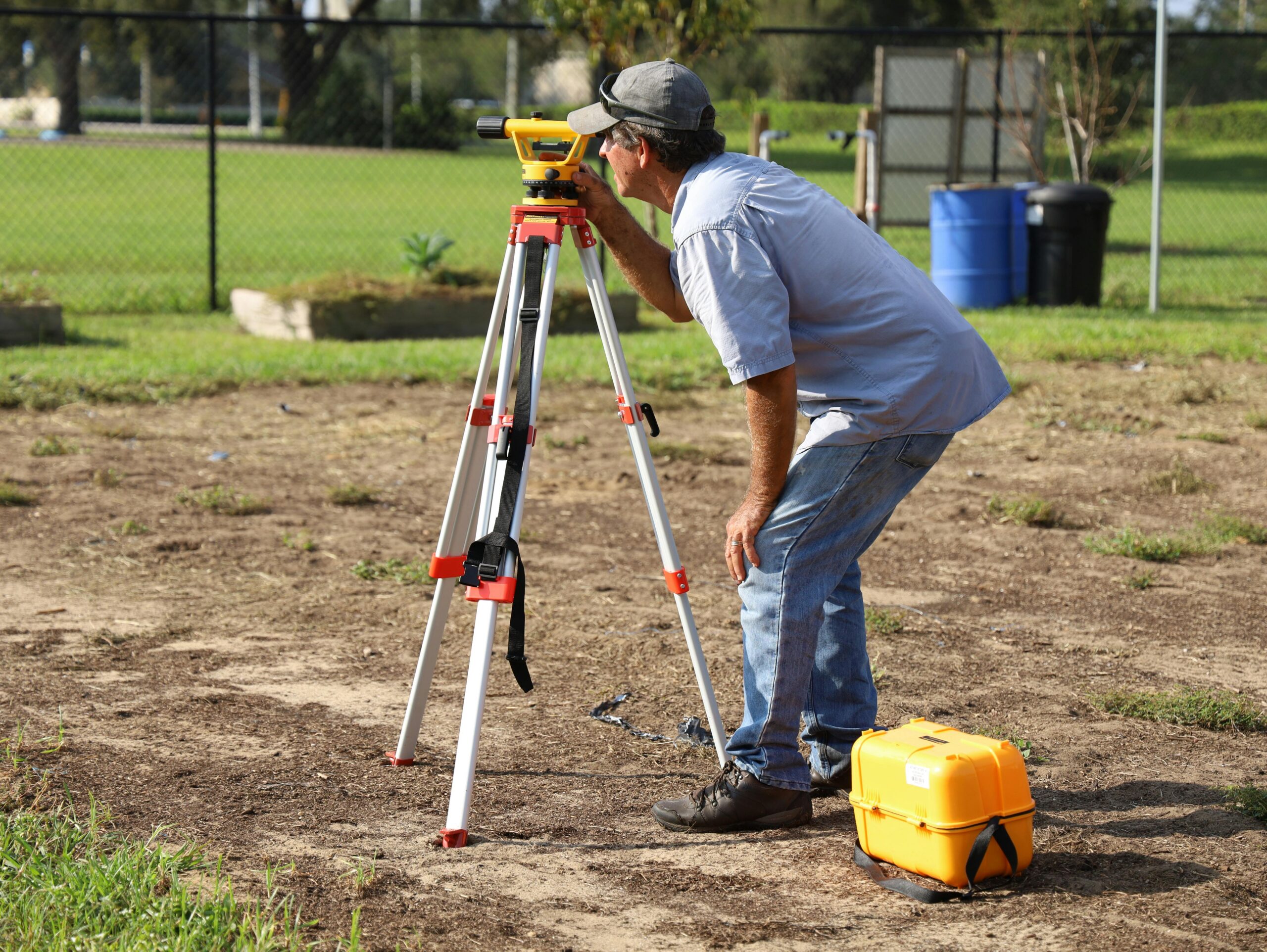
🏗️ When to Hire a Professional Surveyor
Despite the availability of DIY measurement tools, certain situations absolutely require professional surveying services. Legal property transactions, boundary disputes, subdivision applications, and construction permits typically demand certified survey documents.
Licensed surveyors carry professional liability insurance and stake their reputation on accurate work. They access official property records, understand local regulations, and use equipment calibrated to professional standards. Their work creates legally binding documentation that protects all parties in real estate transactions.
The cost of professional surveys varies widely based on property size, terrain difficulty, and regional rates. Expect to pay anywhere from a few hundred dollars for a simple residential lot to several thousand for large or complex properties. This investment provides peace of mind and legal protection worth far more than the initial expense.
🌾 Special Considerations for Agricultural Land
Farmers and agricultural professionals have unique measurement needs that go beyond simple area calculation. Field mapping helps optimize planting patterns, calculate crop yields, plan irrigation systems, and manage land use rotations.
Modern precision agriculture relies heavily on accurate field measurements combined with soil data, elevation mapping, and historical yield information. GPS-enabled tractors use field boundaries to automate planting and harvesting, maximizing efficiency while minimizing waste and environmental impact.
Many farmers use measurement apps to track individual field performance over multiple seasons. This data-driven approach identifies which areas produce best, where drainage improvements are needed, and how to maximize the productivity of every acre under cultivation.
🏡 Residential Property Measurement Tips
Homeowners measuring their property should start by locating existing survey markers, often found at corners buried slightly below ground. Metal detectors can help find iron pins or rebar markers placed by previous surveys.
Property deeds sometimes include measurement descriptions, though these may be outdated or imprecise. Comparing your measurements with deed descriptions helps verify you’re measuring the correct boundaries. Significant discrepancies warrant professional investigation before making property improvements.
When measuring for specific projects like fencing or landscaping, add a small buffer to account for measurement uncertainty. Ordering 5-10% extra materials prevents costly project delays while usually costing less than expedited reorders if you come up short.
📊 Understanding Different Area Units
Land area can be expressed in various units depending on location and context. Understanding these conversions helps you interpret property listings, agricultural data, and construction documents accurately.
| Unit | Equivalent | Common Use |
|---|---|---|
| Acre | 43,560 square feet | US residential and agricultural |
| Hectare | 10,000 square meters | International agricultural |
| Square meter | 10.76 square feet | International construction |
| Square foot | 0.093 square meters | US construction and real estate |
One acre equals approximately 0.405 hectares, making conversion relatively straightforward. Most measurement apps automatically display results in multiple units, eliminating the need for manual calculation and reducing conversion errors.
🔧 Tools and Equipment Recommendations
Choosing the right measurement tools depends on your specific needs, budget, and frequency of use. Occasional users measuring small residential plots can rely entirely on smartphone apps, while professionals require specialized equipment.
Essential Tools for DIY Measurement
- Smartphone with GPS capability and measurement app installed
- 100-foot measuring tape for verification and detail work
- Survey marking flags or stakes to mark corners and points of interest
- Notebook or digital note-taking app to record measurements and observations
- Compass or smartphone compass app for orientation reference
Professional-Grade Equipment
- Differential GPS receiver for sub-meter accuracy
- Laser distance measurer for precise short-distance measurements
- Digital theodolite for angle measurements on irregular plots
- Drone with mapping software for large or inaccessible properties
- Total station for comprehensive surveying projects
🎯 Step-by-Step Measurement Process
Successfully measuring land requires methodical approach and attention to detail. Following a consistent process ensures you don’t miss important elements and can reproduce your results if needed.
Begin by walking the entire property perimeter to identify boundaries, obstacles, and terrain features. Look for existing survey markers, fences, property pins, or natural boundaries like streams or tree lines that define property limits.
Clear any vegetation or debris that might obstruct your path or interfere with GPS signal reception. While you don’t need to create a perfectly clear path, removing major obstructions improves measurement accuracy and safety during the measurement process.
Start your measurement at a clearly defined corner or landmark that you can easily locate again. If using a GPS app, allow the device to acquire satellites and stabilize before beginning. Walk at a steady, moderate pace around the perimeter, holding your device at consistent height.
Mark your starting point clearly so you know when you’ve completed the full circuit. Most apps require you to close the polygon by returning to your starting location. Take note of any areas where you had to deviate from the actual boundary due to obstacles.
⚠️ Common Measurement Mistakes to Avoid
Even with excellent tools, certain errors can compromise measurement accuracy. Being aware of these pitfalls helps you avoid them and recognize when results seem questionable.
Poor GPS signal conditions represent the most common source of smartphone measurement errors. Measuring during heavy cloud cover, near tall buildings, or under dense tree canopy degrades GPS accuracy significantly. Whenever possible, measure on clear days in open areas.
Failing to account for slopes and elevation changes leads to underestimating actual ground surface area. GPS measurements typically calculate horizontal projection rather than actual sloped surface area. On hilly terrain, this difference can be substantial.
Rushing the measurement process prevents GPS devices from acquiring accurate position data. Walking too quickly or making jerky movements introduces noise into the position tracking, resulting in irregular boundary lines and inaccurate area calculations.
💡 Maximizing Accuracy with Available Tools
Regardless of which measurement method you choose, certain techniques improve accuracy and reliability. Professional surveyors employ these practices, and DIY measurers benefit equally from applying them.
Measure properties multiple times and compare results. Significant variation between measurements indicates problems with technique, equipment, or environmental conditions. Consistent results across multiple measurements build confidence in accuracy.
Verify GPS measurements against known dimensions whenever possible. If your property has a street frontage with documented length, measure just that segment and compare with official records. This calibration helps assess overall measurement reliability.
Document environmental conditions during measurement including weather, time of day, and any obstacles encountered. This information proves valuable if questions arise later about measurement accuracy or if you need to repeat measurements under similar conditions.
🌟 Future Trends in Land Measurement Technology
Emerging technologies promise to make land measurement even more accessible and accurate. Drone-based photogrammetry already allows detailed property mapping from aerial imagery, and costs continue to decrease as the technology matures.
Augmented reality applications may soon overlay property boundaries and measurements directly onto smartphone camera views, making it easier to visualize property lines and understand spatial relationships. This technology could revolutionize boundary identification and dispute resolution.
Improved GPS satellite networks including Europe’s Galileo and other international systems provide more satellites and better coverage, directly improving civilian GPS accuracy. Future smartphones may achieve professional-grade positioning without specialized external hardware.
📝 Documenting and Preserving Your Measurements
Accurate measurements lose value if poorly documented or lost over time. Creating organized records with context and supporting information transforms raw measurements into valuable property intelligence.
Export measurement data in multiple formats including PDF documents, image files, and raw data formats if your measurement app supports it. Store these files in multiple locations including cloud storage services to prevent loss due to device failure or damage.
Include photographs of property corners, boundary markers, and distinctive features alongside your measurement data. Visual documentation helps you and others understand exactly what was measured and identify the same locations during future verification or remeasurement efforts.
Note the date, tools used, person who performed the measurement, and purpose for which it was conducted. This metadata provides context that becomes increasingly valuable over time as memory fades and circumstances change.
Measuring land has evolved from an exclusive professional service to an accessible task that property owners can often handle themselves with readily available tools. Whether you choose traditional methods, modern GPS applications, or professional surveying services depends on your specific accuracy requirements, budget, and intended use of the measurements. Understanding the capabilities and limitations of each approach empowers you to make informed decisions and achieve reliable results that serve your property management, development, or transaction needs effectively.